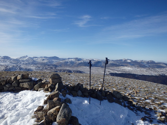
White Side is a 863m (2832ft) fell in Cumberland/Westmorland and Furness classified as a Wainwright, one of 214 Lake District fells. Check today's White Side summit weather including wind speed, temperature, rain risk and cloud cover before heading out. Weather on the Lake District fells can change quickly at this altitude.
White Side is a fell in the English Lake District. It is situated to the east of Thirlmere and to the west of Glenridding valley.
Geology: The bedrock here is Birker Fell Andesite Formation — Andesite — a volcanic rock commonly found at continental margins and island arcs. Age: Caradoc Series.
Planning to walk White Side? Our summit weather forecast shows live conditions at 863m including wind speed, wind chill, temperature, freezing level, cloud base and rain risk. The forecast updates hourly using data from 7 weather models blended into the HILLANDGLEN ensemble — accuracy-weighted so the best-performing models have the most influence.
Key conditions to check before climbing White Side: wind chill (the real temperature you'll feel on exposed ridges), freezing level (whether ice and snow are likely on the summit), cloud base (whether you'll have visibility at 863m), and wind gusts (which can be significantly stronger on fell tops than in the valley below).
White Side weather can change quickly at 863m. Valley conditions often differ from the summit — our forecast applies lapse rate adjustments to give you the actual temperature and wind at the top, not the nearest town. Check the 14-day outlook to find the best day to walk White Side.
Frequently Asked Questions
How high is White Side?
White Side is 863 metres (2832 feet) above sea level. It is classified as a Wainwright in the Lake District.
What is the weather like on White Side?
At 863m, conditions on White Side are noticeably different from the valley floor. Expect temperatures 4-6°C colder at the summit, stronger winds on exposed sections, and cloud that can sit on the tops. Check the live summit forecast on hillandglen.com for wind chill, rain risk and visibility before your walk.
Is White Side a difficult walk?
White Side at 863m is a moderate fell walk. The main challenges are weather-related: wind, rain and poor visibility can make navigation harder. Check the summit forecast before setting out and carry waterproofs, warm layers and a map.
What is a Wainwright?
A Wainwright is one of the 214 fells in the English Lake District described by Alfred Wainwright in his seven-volume Pictorial Guide to the Lakeland Fells, published between 1955 and 1966. Completing all 214 is a popular walking challenge.
When is the best time to walk White Side?
The best months for walking White Side are typically May to September, when days are longest and weather is generally drier. Summer offers the best visibility and warmest conditions. Autumn (October-November) brings beautiful colours but shorter days. Autumn can also be excellent with clearer skies and golden light.
Free summit weather forecasts for over 20,000 British and Irish hills. Designed for hikers, runners, and climbers who need accurate mountain conditions — not just city weather.